Like the species maps, the Download Data tool can be found under the “Explore” menu of the NatureCounts website. You can also navigate to Download Data directly from the Species Maps using the tabs above the map, and your search parameters from the maps tool will be preserved.
The Download Data tool is where you can access and download any of the available data in NatureCounts. By default, the list on the right shows all available datasets and records.
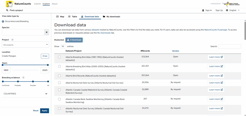
You can narrow your data search using the various options on the left side. You can search for data on a specific species, from a certain project(s), within a defined year range, or with a particular level(s) of breeding evidence. You can also limit your search to a small study site or geographical area of interest by clicking “Draw polygon”.
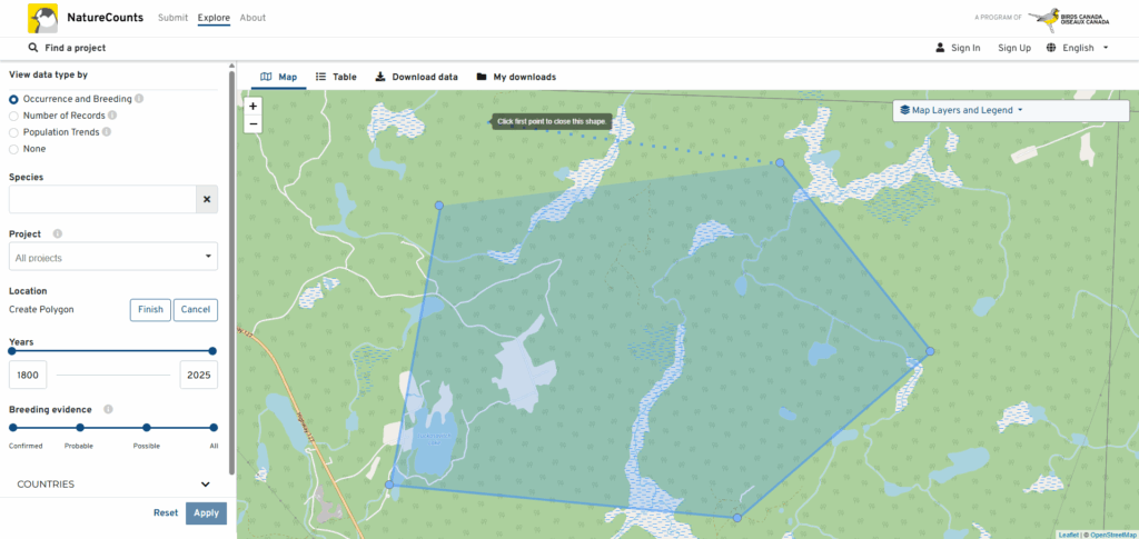
Clicking “Draw polygon” will take to the map tool. Click on the map to begin drawing a custom polygon around the area you are interested in. If you make a mistake, simply click “Cancel”, then “Draw polygon” to start again. Once you are satisfied, click “Apply” and you will be redirected to the Download Data tool.
Anytime you click “Apply”, the list on the right will update to display only datasets with records that match your search criteria. For each dataset, you will see the number of relevant records, whether the dataset is open or available by request, and an option to view that dataset’s metadata by clicking “Learn more”.
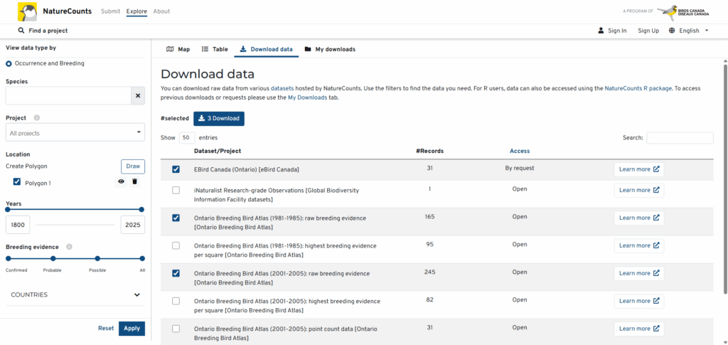
To access the data you want, simply click the checkbox beside each dataset you are interested in and click “Download”. The next section will take you through the short process of requesting the data, and tell you what to expect from the review process.
Next Section: The Request and Review Process